Maxar publishes new satellite images of destroyed Kakhovka HPP
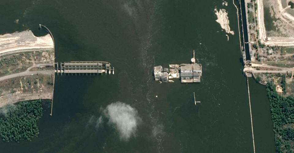
Maxar Technologies has published satellite images of the Kakhovka HPP destroyed by Russian troops
Radio Svoboda’s Schemes project reported the information.
The images show the dam destroyed by Russian troops and the flooded neighborhood.

Photo: Maxar
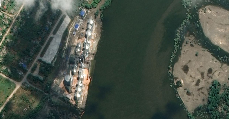
Also, one of the images shows the Nibulon river terminal in the village of Kozatske, near the destroyed hydroelectric power plant.
Earlier, the terminal was completely flooded, but recent satellite images show that the water level has begun to fall.

Photo: Maxar
-
On June 6, the Russian occupying forces blew up the Kakhovka HPP, completely destroying it. As a result of the tragedy, settlements in the Kherson region and Kherson city, as well as villages and towns in the Mykolaiv region, were flooded. For a detailed account of the events, click here.
-
On June 14, the European Parliament recognized the destruction of the Kakhovka HPP as a war crime.
- News


