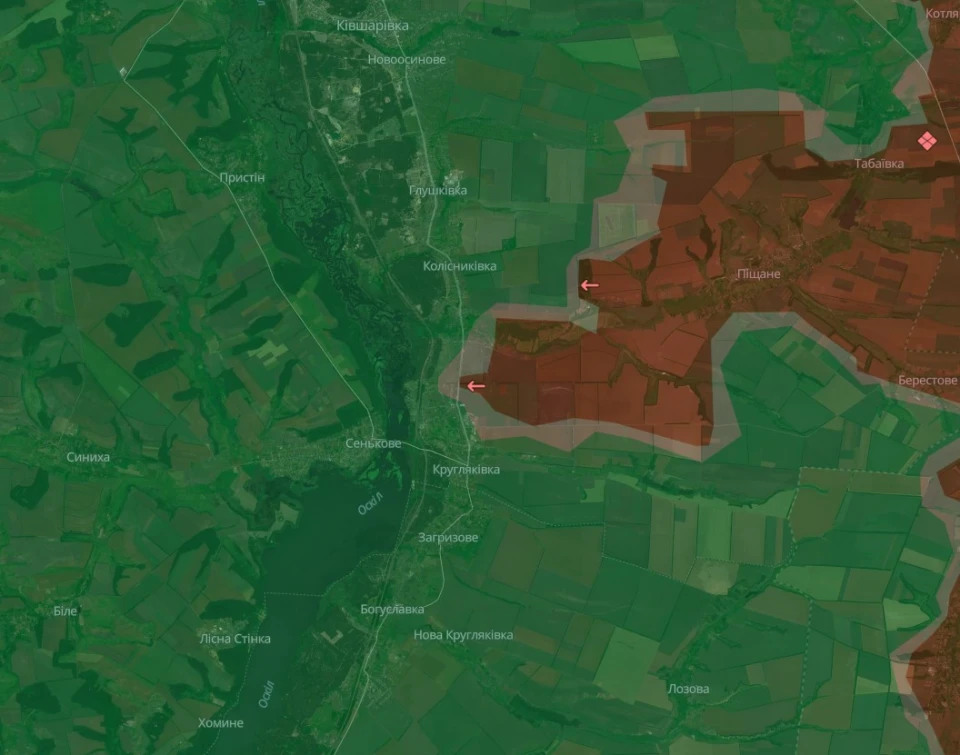
Russian army reaches highway connecting Kupyansk with Borova in Kharkiv region
As of Sunday, October 13, 2024, Russian forces managed to reach the Kupyansk-Borova motorway in the Kharkiv region
The interactive map of the Ukrainian non-governmental OSINT project DeepState evidences this.
It shows the Russian army's access to a section of the Kupyansk-Borova road between the villages of Kruglyakivka and Kolisnykivka. This road connects two district centres of Kharkiv region: the current one (Kupyansk) and the former one (Borova), which had this status before the administrative-territorial reform of 2015-2020, the emergence of territorial communities and, as a result, an increase in the size of districts.

The motorway runs along the eastern bank of the Oskil River.
The place of the breakthrough and the corresponding Russian foothold looks like a ‘wedge’ in the Ukrainian defense line along the Oskil.
Using the Time Line feature on Deepstatemap.live, it is possible to establish the time spent by the Russian forces moving from the village of Pishchane, which they have held for a long time, to the Kupyansk-Borova road. Since the beginning of August 2024, it has taken them over 2 months.
What the General Staff of the Ukrainian Armed Forces says
‘Repulsed assault actions’ of the enemy near the villages of Kolisnykivka and Kruglyakivka in the Kupyansk sector were mentioned in the morning report of the General Staff of the Armed Forces of Ukraine for Sunday, October 13.
- At the same time, the Russian army has not stopped shelling the town of Kupyansk, namely civilian objects located there and its civilians.
- News


