
'Likely Palianytsia missile': strike on Russian oil refinery, cutting-edge tech Ukrainian innovators offer military. Serhiy Zgurets’ column

On February 5, 150 Ukrainian defenders were successfully returned from Russian captivity. Overnight, Ukraine's Defense Forces attacked an oil refinery in Russia's Krasnodar region
Ukrainian POWs return home
I'll start with some good news: yesterday, Ukraine returned 150 of our defenders from Russian captivity. These are soldiers, sergeants, officers of the Navy, Air Force, Airborne Assault Forces, Ground Forces, National Guard, border guards, and territorial defense forces who were captured in Mariupol and Zaporizhzhia region. Some of these guys had been in captivity for over two years, so this is truly great news.
Strike on Russian oil refinery
And now for more good news. Yesterday, Ukrainian Armed Forces and drones attacked Russian military targets in the Krasnodar region of the Russian Federation. The invaders reported a fire at the Russian Albashnafta facility. This is essentially a small oil refinery involved in supplying gasoline and diesel to the Russian occupation army. There doesn't seem to be anything particularly special about this news, but there is one detail.
In one video, it is noticeable that the projectile attacking the Russian oil refinery is glowing. This means that it is not just an ordinary drone typically used for strikes on Russian targets, but likely a cruise missile used for the strike on the Russian refinery.
This is, in fact, the first video suggesting that Ukrainian new developments, specifically the likely Palianytsia missile with a range of up to 700 kilometers, may have been used in the strike on the Russian oil refinery. Additionally, speaking of statistics, last year, strikes were carried out on more than 83 Russian targets. In January alone, there were already 20 such strikes. We'll see what happens in February; this process is gaining momentum.
Russia continues drone attacks on Ukraine
Yesterday, the Russian Federation also launched a Shahed drone attack on Ukraine. A total of 104 drones were used, half of which were shot down, while the other half were lost. The Russians are increasing the number of Shaheds in their attacks. For example, in January 2024, Russia used 378 drones in attacks, whereas in January 2025, this number surged to 2,599.
We are witnessing a rise in the number of Russian drones, which means our countermeasures must be highly effective. Fortunately, all drones used by Russian forces are being neutralized either by air defense systems or by our standby units, which have the capability to destroy these enemy weapons.
Ukrainian innovators present new technologies for military
Now, let's talk about new technological solutions that enhance the power and effectiveness of our Armed Forces. Just two days ago, we discussed robotic platforms produced in the Ternopil region. Now, we'll focus on the developments of Farsight Vision, an international company led by a team from Lviv.
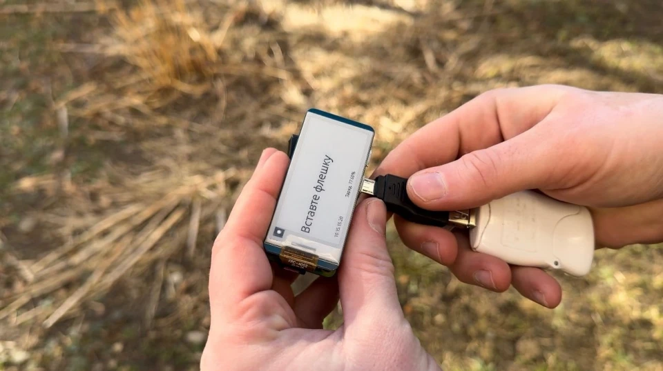
"Our entire story began with this device, which we started developing because most of our drone and reconnaissance aircraft flights take place under electronic warfare conditions. As a result, it's impossible to constantly receive real-time information about geographic coordinates, the unfolding situation, or the location of key objects. So, it was crucial to figure out how to process the data collected by our drones and reconnaissance aircraft into digital maps and 3D models, linking them to geographic coordinates and identifying key objects. This also allows us to track changes on maps. Thanks to this device, we enable mission planning, adjustments, and various operational tasks," explained Viktoria Yaremchuk, CEO and co-founder of Farsight Vision.
As I understand it, a drone flies over a certain area, recording video - rather than just taking photos - with its camera. After the flight, the operator inserts the data storage device into this system, which then generates a digital terrain map with elevation details. This provides operators with a more detailed understanding of object locations and heights, enhancing their situational awareness and targeting accuracy.
"It is very important that, as we know, drones transmit data in flight mode. So, they stream data, and the operators, or those viewing the streams, can see objects. But they can't see or know exactly where these objects are. For example, they might see a tank on the stream, but it's hard to understand where it is because the drone is moving. Therefore, the ability to obtain geo-tagged objects of interest is crucial for two reasons: first, to act on them correctly, and second, to plan the next steps regarding enemy movements," she explained.
According to the operators, when they received video, processing it could sometimes take up to eight hours. But now, with this solution, we can quickly determine what has changed on the ground, where an enemy object has appeared, and even identify the type of object. Additionally, we have a better understanding of elevation, showing us exactly where this is happening. In other words, this is a new added reality with new data, allowing our units to operate more effectively.
"Actually, eight hours is an optimistic time, and sometimes it can be significantly longer. Our goal was to reduce this period to one hour and, if possible, shorten it further to 30 minutes or so. Additionally, we know that the front line changes very dynamically, and any available maps or even satellite images do not provide an accurate picture, such as road junctions, intersections, or just the general terrain. The situation can often change drastically within hours when a tactical group or infantry fighting vehicle moves in," noted Viktoria Yaremchuk.
So, when the Defense Forces move across a certain area, it is important to understand the condition of that terrain, where they are heading, and how the landscape has changed: "Because, imagine, we are traveling in a vehicle - an infantry fighting vehicle or a tank - and we arrive at a point where the map shows a road intersection, but in reality, there’s nothing - just craters, and we don’t know where to go next. Having a 3D model, freshly generated from a drone or aircraft flight, allows us to orient ourselves on the ground quickly and, when planning, avoid additional casualties if possible."
"At the moment, we are working with virtually all types of multirotors, meaning various drones that perform not only reconnaissance functions but also reconnaissance and so-called ASR wings, which carry out both reconnaissance and combined missions. We do not work with FPV drones, because there are certain aerodynamics features in flight and the execution of other tasks," explained Viktoria Yaremchuk, co-founder of Farsight Vision.
We know that our military uses the widely used software Kropyva, both in terms of software and the tablet itself, which allows operators to have multiple layers of understanding of the information.
Viktoria Yaremchuk also shared how adaptable their solution is to the Kropyva tablet.
"It is actually very important to collaborate with the ecosystem of solutions in order to enhance the existing ones. And in the context of full-scale war, where the situation on the front changes rapidly and there are many unknowns, it's much better to work with familiar tools and strengthen them, rather than providing an overwhelming number of different tools that don't work together. That’s why we provide these layers of maps, both in Kropyva and in the situational awareness system Delta. As a result, our users, our Defense Forces, can use fresh orthophoto maps and 3D models as layers in Kropyva or Delta," she noted.
Various Ukrainian units are purchasing both software and devices from Farsight Vision.
"I haven't mentioned yet that the layers we process from flights of aircraft and drones are also used by battle management systems, such as Combat Vision and Attack. So, for various applications and objectives, and without mentioning specific units or divisions for obvious reasons, different divisions or Defense Forces use them. And it's not just the Armed Forces. It's the broader Defense Forces, primarily for mission planning and reconnaissance, but also for other purposes: corrections or to train pilots of various unmanned aerial systems. So, in reality, we work on different levels. Mostly, it's the tactical level, but the maps can also be used at higher levels," explained the specialist.
For me, it was a bit of a surprise when I learned about this solution. Viktoria Yaremchuk noted that their developments are known to many Ukrainian defenders.
"We actually collaborate with quite a few units, but I don't want to mention specifics because it's sensitive information. However, I can say that most of the time, we are used by those brigades, regiments, or battalions that are inclined to embrace innovations and technological breakthroughs. We have had quite successful results working alongside other available tools. We are very open to collaboration with different branches of the military. Given the demand to use elements like 3D modeling for situational awareness across various branches of the armed forces," she said.
The co-founder of Farside Vision noted that they expect further implementation of their tools and integration with other instruments, as such solutions provide speed and enhance the ability to understand the situation better.
"And ultimately, this helps reduce the number of losses on our side. I'd also like to mention that only a small number of people currently use one of our features, augmented reality. This can be accessed either through VR glasses or VR helmets to provide full immersion in understanding the situation. For example, a drone flew over an unfamiliar area, we obtained a 3D model, which was then loaded into the VR glasses. The pilot or mission leader, who will be operating in that area, can virtually walk through it before people actually enter, giving them an understanding of what to expect while there," she said.
It’s also worth mentioning the development of ground robotic platforms, where terrain navigation can be challenging. Sometimes, it’s unclear where there’s a pit and where there isn’t.
"In fact, we are already working with several developers and manufacturers of ground robotic complexes to assist in navigation based on elevation maps and understanding changes in the landscape. This is because, again, the data provided by satellite images or official maps is often outdated, inaccurate, or contains discrepancies due to weather conditions. For example, in conditions of cloud cover or fog, satellite images may be ineffective and even unnecessary," the expert noted.
Viktoria Yaremchuk has ten years of startup experience, having worked in the American and European markets. She explained whether these solutions are unique.
"Communication, for example, with specialists and experts interested from NATO countries, as well as from previous experience working with software products in the American and Western European markets regarding geoinformation systems, I can say that there is great hope in NATO countries for satellites. There is a huge belief that satellites will solve everything. However, in the front-line conditions in Ukraine, they are mistaken, unfortunately. The front changes so dynamically, and the situation evolves so quickly, that it is impossible to obtain highly detailed satellite information as fast and frequently as needed at the moment. It is possible that technologies will evolve, and perhaps we will be able to get this information after some time. But at the moment, it is not possible, and in fact, it is also very expensive," she said.
An entire ecosystem and infrastructure are also required to manage the processing of the vast array of satellite data.
"At the same time, in contrast to this, the solution of using data from drones or reconnaissance aircraft not only reduces costs but actually refines data in a certain area where the situation changes very quickly, and provides a real advantage - both quantitative and qualitative. The uniqueness lies in the fact that certain existing technologies are used in a completely different way with the addition of some innovations, such as processing in conditions without GPS, GNSS, or GPS coordinates, processing within the ecosystem of situational awareness tools or combat management," she said.
The specialist noted that analytics can sometimes be accelerated by tens of times.
"Providing the opportunity through these tools, through these fresh maps, for adjacent units to collaborate quickly and efficiently is crucial. What's also very important - and this is something that speeds up analytics by many times, sometimes even by tens of times - is the use of artificial intelligence models that we developed not only to analyze past changes, such as on map layers, but also to predict changes. Because the ability to analyze how shots were made, the shooting pattern, how they occur at different times of the day, and to find their logistics - how and when they are planned - enables us to predict changes," said Viktoria Yaremchuk.
So, effectively, we must also include artificial intelligence, image recognition, and the creation of databases in this area.
"Therefore, we decided that we should not only provide the technology that processes the data but also a platform that enables analytical work with this data, and by accumulating data, provide this historical-predictive way of working with it," she noted.
Farside Vision collaborates with the Ukrainian government.
"We are very fortunate to be part of the BreyOne platform, which helps and connects teams of companies developing solutions for the Defense Forces. It works with ministries, as well as with representatives of the Defense Forces, and helps even teams to collaborate for better results for the Defense Forces. I would like to take this opportunity to thank the team for working 24/7, every day of the week, supporting both our users and in development, because we have a truly unique situation where we receive feedback from our users and provide results based on that feedback. Sometimes it's within an hour, sometimes it’s several hours, and so on - this is an extremely fast exchange," she said.
Viktoria Yaremchuk emphasized that all her colleagues are united by one goal.
"The team somehow manages in such a stressful situation. But, in fact, these are specialists and people, probably with common interests, who came together. I would, of course, like to highlight co-founder Volodymyr Nepyuk, who agreed to get involved in this rather complex technological story. But we are all united by one motivation, actually. And so, the people who got involved, I can't name them, except for Volodymyr. They are all specialists in very narrow fields. This includes 3D modeling, XR or VR, Computer Vision, artificial intelligence, geospatial systems, and so on. And, of course, our motivation is obvious - it’s to build a product that can then be used. Right now, we hope, and we see this feedback, that it helps the Armed Forces, but it can help not only the Armed Forces," said Viktoria Yaremchuk, CEO and co-founder of Farside Vision.


- News